Anschuetz Adds Generic Overlay for SYNAPSIS ECDIS NX
© Anschuetz
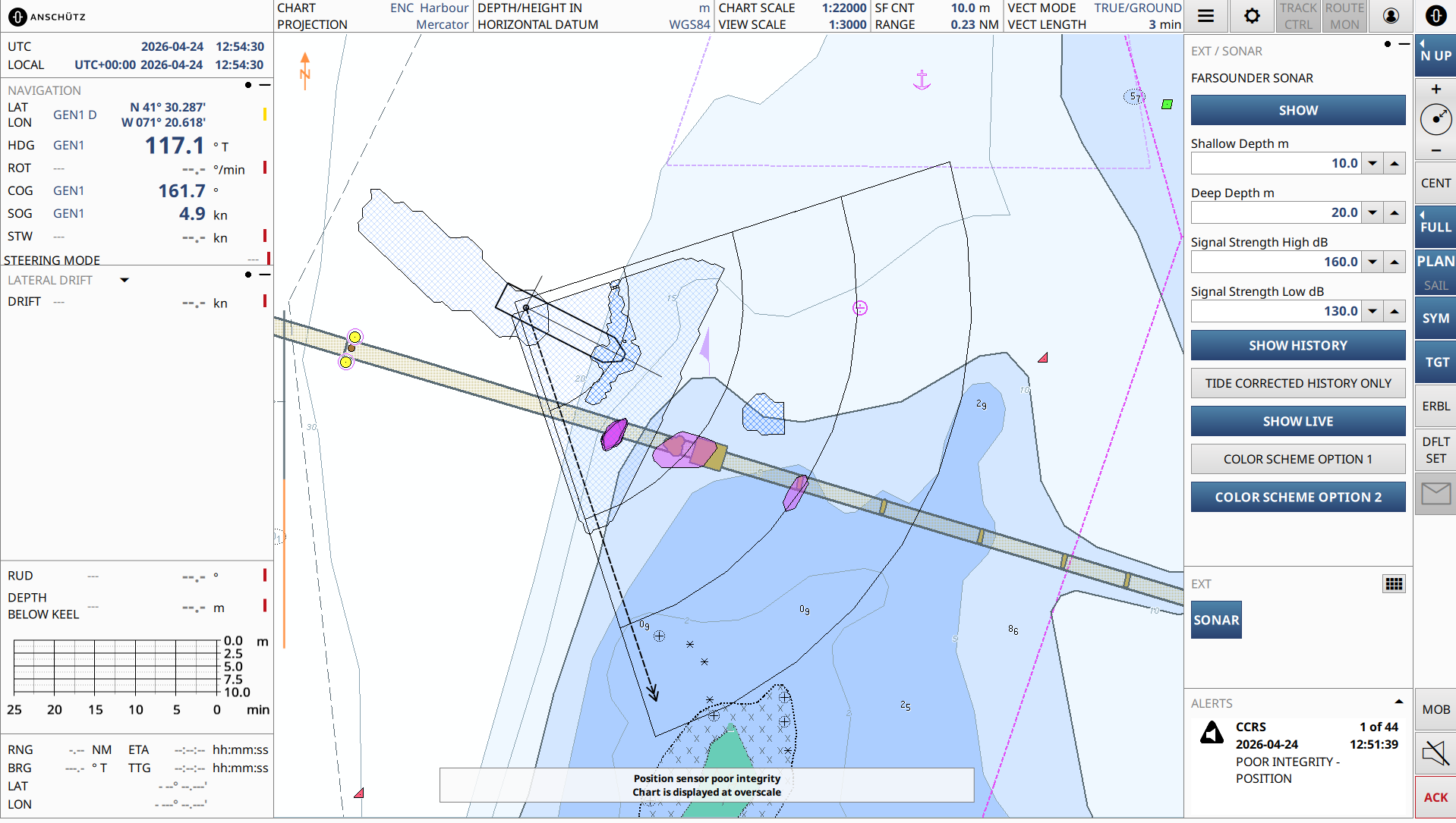
Anschuetz has added the Generic Overlay feature, which extends SYNAPSIS (W)ECDIS NX by enabling the direct display of external, geo-referenced data within the chart. Third-party systems can provide their information as overlay layers, visualized seamlessly alongside standard navigational data in a consistent spatial context.
Based on a standardized, generic interface, external applications can be connected to the Electronic Chart Display and Information System (ECDIS) itself without any modification. Once integrated, the system adapts automatically, generating menus, controls and visual elements dynamically in line with the connected data source.
Practical application: forward-looking sonar
The first implementation of Generic Overlay integrates FarSounder’s 3D forward-looking sonar into SYNAPSIS ECDIS NX. Real-time detection of in-water targets and seabed structures is displayed directly on the chart, complementing existing navigational information.
Operators can differentiate clearly between underwater objects, such as rocks or obstacles, and seabed depth information, with visualization adapted to signal strength and depth ranges. Both live and historical data can be accessed and controlled independently, allowing users to assess current conditions while maintaining spatial context.
The result is an improved understanding of the environment ahead of the vessel. In practical scenarios such as port approaches, anchoring or navigation in poorly charted waters, forward-looking information supports early risk detection, more precise maneuvering and greater confidence in decision-making.
Scalable integration concept
Generic Overlay enables the straightforward addition of further data sources beyond individual integrations. New applications can be incorporated with minimal effort, supporting a wide range of use cases and future system extensions.
Consistent integration into the existing user interface ensures that additional data remains clearly structured and easy to operate. Even with multiple data layers, information is easy to follow, avoiding unnecessary complexity on the bridge.
Supporting safe and efficient navigation
By consolidating external sensor data within the ECDIS, Generic Overlay ensures that relevant information is available directly in the navigational context. This reduces interpretation gaps between systems, allowing operators to relate sensor data immediately to charted information and vessel position.
Operators can draw on both real-time and historical data, with clear visual differentiation and centralized access, to recognize hazards earlier and assess situations more accurately. Navigators can therefore act with greater precision and consistency, particularly in dynamic or confined environments.