Jeppesen
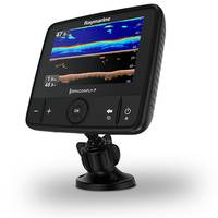
Raymarine Launches Larger Dragonfly 7 PRO
Raymarine is calling the new Dragonfly 7 PRO its most feature-rich sonar/GPS combination yet for fresh and coastal saltwater fishing. Offering the same features as the Dragonfly 5 PRO, Dragonfly 7 PRO is equipped with a larger 7-inch display for maximum visibility. The super bright display is also optically-bonded for all-weather performance, and is guaranteed to never fog up, the manufacturer said. Dragonfly 7 PRO’s DownVision sonar uses wide spectrum CHIRP technology to transmit across multiple sonar frequencies simultaneously.

Lowrance Updates Software for HDS Displays
Lowrance released new software updates for its Lowrance High Definition System (HDS) Gen2 Touch and HDS Gen3 multifunction displays. The newest releases are version 4.5 for HDS Gen2 Touch and version 2.0 for the HDS Gen3. They provide users with features including Outboard Pilot control, C-MAP MAX-N+ 2015 compatibility and Power-Pole integration. Bringing new functionality to HDS Gen3 users, the updated software leverages built-in Bluetooth wireless technology to allow for control of Power-Pole shallow-water anchors, as well as the all-electric MICRO Anchor products.

Navico Launches GoFree Brand
Navico, manufacturer of marine electronics and parent company to the Lowrance, Simrad and B&G brands, has launched its newest brand, GoFree. Designed to deliver content and services to consumers for use with Lowrance, Simrad and B&G Multifunction Displays (MFDs), as well as mobile devices. GoFree products include all existing Insight charts, Insight Genesis personalized mapping service with Social Map community data sharing, BioBase aquatic map Software as a Service (SaaS), the online GoFree Shop which offers content from Jeppesen…
Raymarine, Jeppesen Partner on Navigation
Raymarine Navigation Displays to support C-MAP by Jeppesen Charts. FLIR Systems announced support for C-MAP by Jeppesen cartography in the company’s range of Raymarine Multifunction Displays. Raymarine and Jeppesen have collaborated for a navigation featuring support for C-MAP 4D across Raymarine’s range of LightHouse II based multifunction displays. The Raymarine line of Dragonfly Sonar/GPS will also support C-MAP, giving anglers access to Jeppesen’s worldwide map library.

iPad App Debuts New Navigation Features
NavPlay, manufacturer of iPad apps for boaters, announced today the latest set of feature driven environments for its NavPlay navigation app, Navigation and Navigation Bridge. Designed to provide an activity-specific control screen, these two new environments, along with the app’s Charting Table and Alarm Manager environments, work hand in hand to seamlessly allow boaters to navigate using an iPad from anywhere on board their vessel. The NavPlay Navigation Bridge environment provides users access to a full suite of instruments linked directly to their iPad.

C-MAP MAX-N+ Cartography Now Available
Global electronic chart provider Jeppesen along with Lowrance, Simrad and B&G brands in marine electronics, have announced the global release of C-MAP MAX-N+ cartography. This revolutionary cartography has been developed to bring new features, advanced chart detail and improved performance to boaters using popular Lowrance HDS Gen2 and Gen2 Touch, Simrad NSS evo2 & NSO evo2, and B&G Zeus2& Zeus Touch chart plotter/multifunction display systems. MAX-N+ gives Lowrance, Simrad and B&G users with compatible systems the benefit of Jeppesen’s global Dynamic Tides and Currents database.
NavPlay Upgrades Chart Table Routing App
NavPlay, a manufacturer of iPad apps for boaters, released the latest feature of its NavPlay navigation app, Chart Table. NavPlay’s exclusive Chart Table is designed to allow boaters to plan routes on their iPad just as they would on their boat’s chart table. A dedicated mobile environment for charting, planning and navigation, NavPlay uses the standard iPad interface making it easy for users to learn and confidently use all features of NavPlay and, in particular, Chart Table. With satellite imagery and C-Map by Jeppesen vector charts…

Lowrance Introduces Elite-4 and Mark-4 HDI Series
Lowrance announced the newest addition to its Elite and Mark family of compact fishfinder and chartplotter products, the Elite-4 and Mark-4 Hybrid Dual Imaging (HDI) series. The new HDI units feature built-in GPS antenna, high-definition mapping options and the Lowrance exclusive Hybrid Dual Imaging technology that combines Broadband Sounder and Downscan Imaging. Replacing previous Lowrance Elite-4 and Mark-4 models, the larger and super-bright Elite 4.3-inch color and Mark grayscale displays have 70 percent more pixels and 36 percent more useable screen area.
Simrad Debuts Dual Screen Navigation
Simrad, a designer and manufacturer of marine electronics, announced its new multifunction navigation system, the Simrad NSO evo2. Setting a new standard in the Glass Bridge navigation experience, the advanced NSO evo2 combines high-power processing for lightning fast charting, sonar, radar and entertainment, dual widescreen displays for uncompromising style, a user interface for intuitive multi-touch control, and compatibility for unrivaled integration. Suited to recreational blue water powerboats and commercial vessels, the NSO evo2 features multifunction navigation.

Jeppesen Launch N. American MAX-L Charts for Boaters
Jeppesen introduce new C-MAP MAX-N Local charts to North American boaters at the 2013 Fort Lauderdale International Boat Show. MAX-N Local charts deliver the trusted Jeppesen chart detail and information boaters need to explore their favorite fishing, diving and cruising spots at what they say is a reasonable cost. The availability of MAX-N Local cartography is important news for the many owners of popular Lowrance Elite 7 and HDS Gen1, Gen2 and Gen2Touch, Simrad NSS, NSE and NSO, and B&G Zeus Touch Multifunction Navigators.
New MAX-N Local Charts Provide Jeppesen Cartography
Jeppesen's new C-MAP MAX-N Local chart release for the EMEA region is made for two things -- compatibility with popular navigation systems from and the demands of cruisers, sailors and fishermen throughout Europe, the Middle East and Africa. New MAX-N Local charts will deliver an enhanced navigation experience to owners of Lowrance Elite 7 and HDS Gen1, Gen2 and Gen2Touch, Simrad NSS, NSE and NSO, and B&G Zeus Touch Multifunction Navigators. Jeppesen's launch of MAX-N cartography puts a new level of accurate chart data and detailed information at the fingertips of boaters navigating the Atlantic European Coasts…
Standard Horizon Upgrades Navigation System
Standard Horizon released a free software upgrade for its CPN Series touch-screen multimedia navigation systems, the 10.1-inch CPN 1010i and seven-inch CPN700i. The update is available through Standard Horizon’s website at standardhorizon.com. By taking advantage of Standard Horizon’s v2.2.2.210 software, users of these advanced C-MAP 4D based chartplotters will unlock enhanced navigation performance, exclusive pairing with Jeppesen’s Plan2Nav mobile app and an improved online and entertainment experience anytime a WiFi hotspot is near.

New Jeppesen Cartography Available
Jeppesen’s new C-MAP MAX-N Wide cartography, designed for popular navigation systems from global marine electronics leader Navico, is now available to boaters worldwide through the Navico Insight Store and Jeppesen authorized dealers. MAX-N Wide is compatible with Lowrance Elite 7 and HDS Gen1, Gen2 and Gen2Touch; Simrad NSS, NSE and NSO and B&G Zeus Touch Multifunction Navigators. These navigation systems have are used across a spectrum of boaters, including fishermen, cruisers and sailors…

Jeppesen, Navico, Provide Compatible Chartplotters
C-MAP by Jeppesen Cartography available on Lowrance, Simrad Yachting and B&G Chartplotters and Multifunction Displays. Navigation experts, Jeppesen, and Navico, a leader in recreational marine electronics and parent company to the Lowrance, Simrad Yachting and B&G brands, have teamed up to provide consumers with a new charting option. C-MAP MAX-N now provides boaters and fishermen with an enhanced navigational experience by offering C-MAP by Jeppesen cartography for Lowrance, Simrad Yachting and B&G brand chartplotters and multifunction displays.
Simrad Brings NS Series to Yachters
Simrad Yachting announced its NS Series offering cartography flexibility. Simrad Yachting provides NS Series Multifunction Devices (MFD) customers embedded Nautic Insight or Navionics coastal cartography and compatibility with Jeppesen C-MAP; Navionics Gold, Platinum and Platinum Plus; and NV Cartography, as well as support for the powerful Insight Genesis chart creation tool. With the NS Series, boaters can chose the chart or charts that best meet their boating needs. www.simrad-yachting.com
'Boat Smart' White Paper Updated
Jeppesen and Alliance for Safe Navigation partners announce updated 'Boat Smart' white paper emphasizing importance of updated charts for navigation. Jeppesen and its Alliance for Safe Navigation (ASN) partners have released an updated version of the educational white paper 'Boat Smart, Update Your Charts', and are making this informative document available to the public, boating journalists, boating organizations and the marine industry through a variety of channels. First produced in 2010, this new version ofBoat Smart, Update Your Charts incorporates the latest published boating accident statistics and contributing factors from the U.S. Coast Guard.
Boat Navigation Android Free App by Jeppesen Released
Jeppesen expands reach of popular Plan2Nav Mobile App with new release for Android hand-held devices. Plan2Nav , the only mobile app designed exclusively for C-MAP by Jeppesen charts, is now available for Android mobile devices. Introduced last year for iPad and iPhone devices, Plan2Nav is a free app that puts the power of trip planning and navigation with C-MAP cartography at boaters’ fingertips. Plan2Nav is an ideal tool for voyage-planning tasks like mapping out a route, setting waypoints and measuring course and distance for each leg of the journey.
SHIPPINGInsight Fleet Optimization Conference Update
Early Bird Pricing Extended for SHIPPINGInsight Fleet Optimization Conference; More than 30 Industry Experts to Address Challenges and Solutions for Reducing Costs and Enhancing Efficiency in Ship Operations. The organizers of the SHIPPINGInsight 2012 Fleet Optimization Conference in Stamford, Conn., have extended the deadline for Early Bird registration until Sept. 21st. The $995 Early Bird registration represents a savings of $400 off the full onsite conference fee of $1,395. Taking place at the Sheraton Stamford Hotel Oct.